Emory Axo
Diagram
Emory Axo
Diagram
Emory Axo
Diagram
Atlanta, Georgia
Year: 2025-2026
Axo Diagram; Personal Project
From a history of chasing projects all desperately chasing meaning and the unquantifiable gesture, I've widely understood abstraction to mostly be a tool of harmful simplification. After all, who are corporations or industries to tell me what art or culture is or isn't?
However, I have come to realize it is in this exact post-modern attitude that we have been left inundated by the various inexplicable feelings, expressions, thoughts; all seemingly unable to be completely categorized into a category. And ultimately, it is still in these abstractions or simplifications that we find meaning (and yes, although undoubtedly abundant) that we can tangibly hold and understand.
To me, that project starts from the communities and systems most directly adjacent to me. In this case: Emory University.
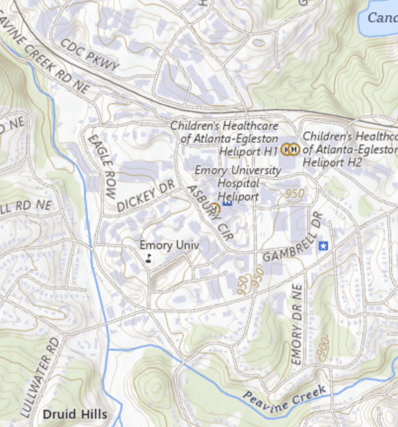
Beyond the traditional 2-D map, I wanted to explore and potentially push the boundaries of abstracting information into tangible formats. And in the realization of the lack of cartographic information at Emory, this project was born.
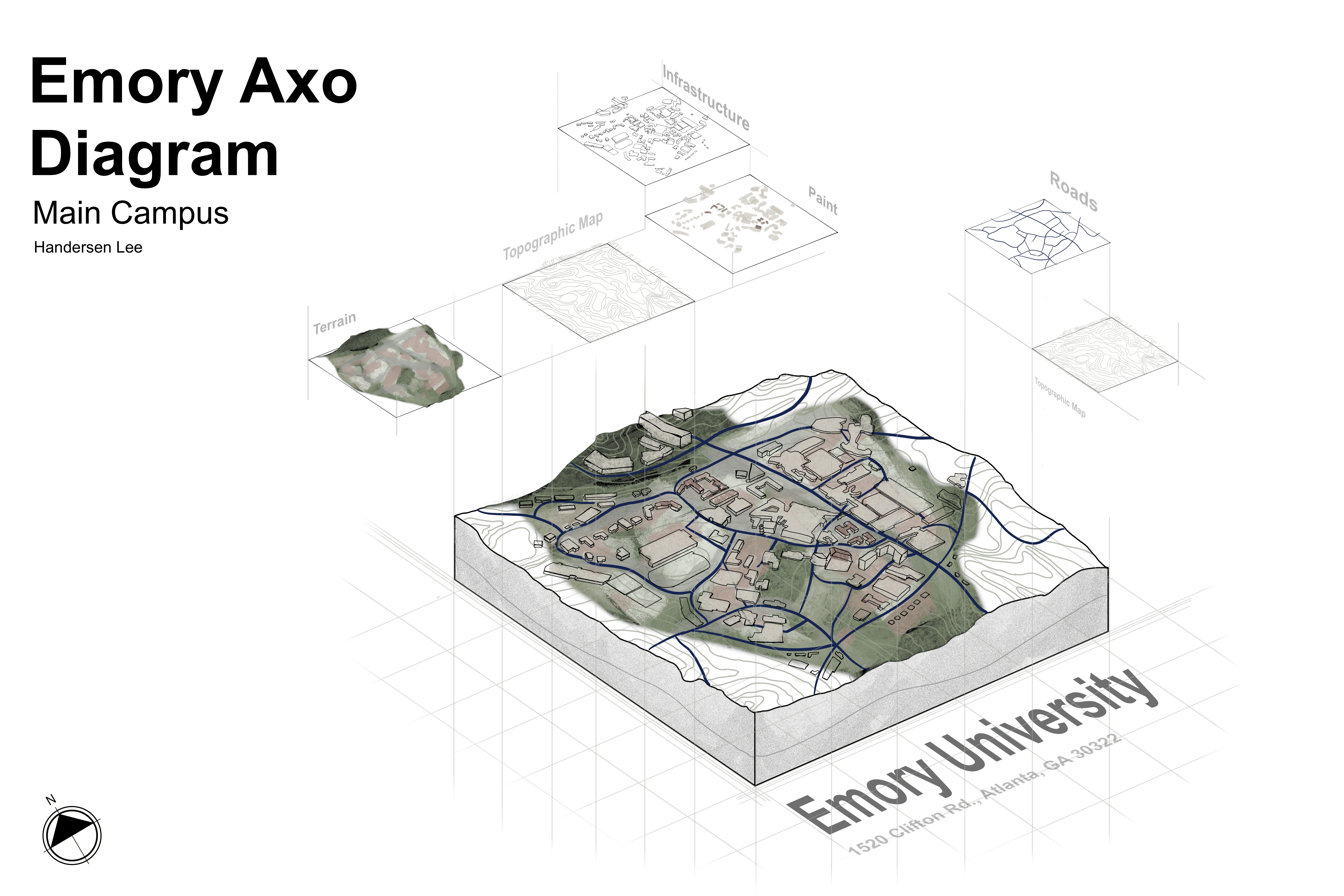
By combining multiple maps (topographic, reference, thematic), state and local terrain data, and personal experience/surveys, I created a diagram to better explore the relationship between terrain, topography, and infrastructure. As is design's nature, the map tends very functional, toggling between various functions and modes, but still aims to explore how these relationships and abstract categories attempt to embody the un-abstractable, lived experience.
After realizing the lack of cartographic information at Emory University beyond a 2-D map, I undertook this diagram as a personal project to understand Emory's campus beyond a 2-D world.
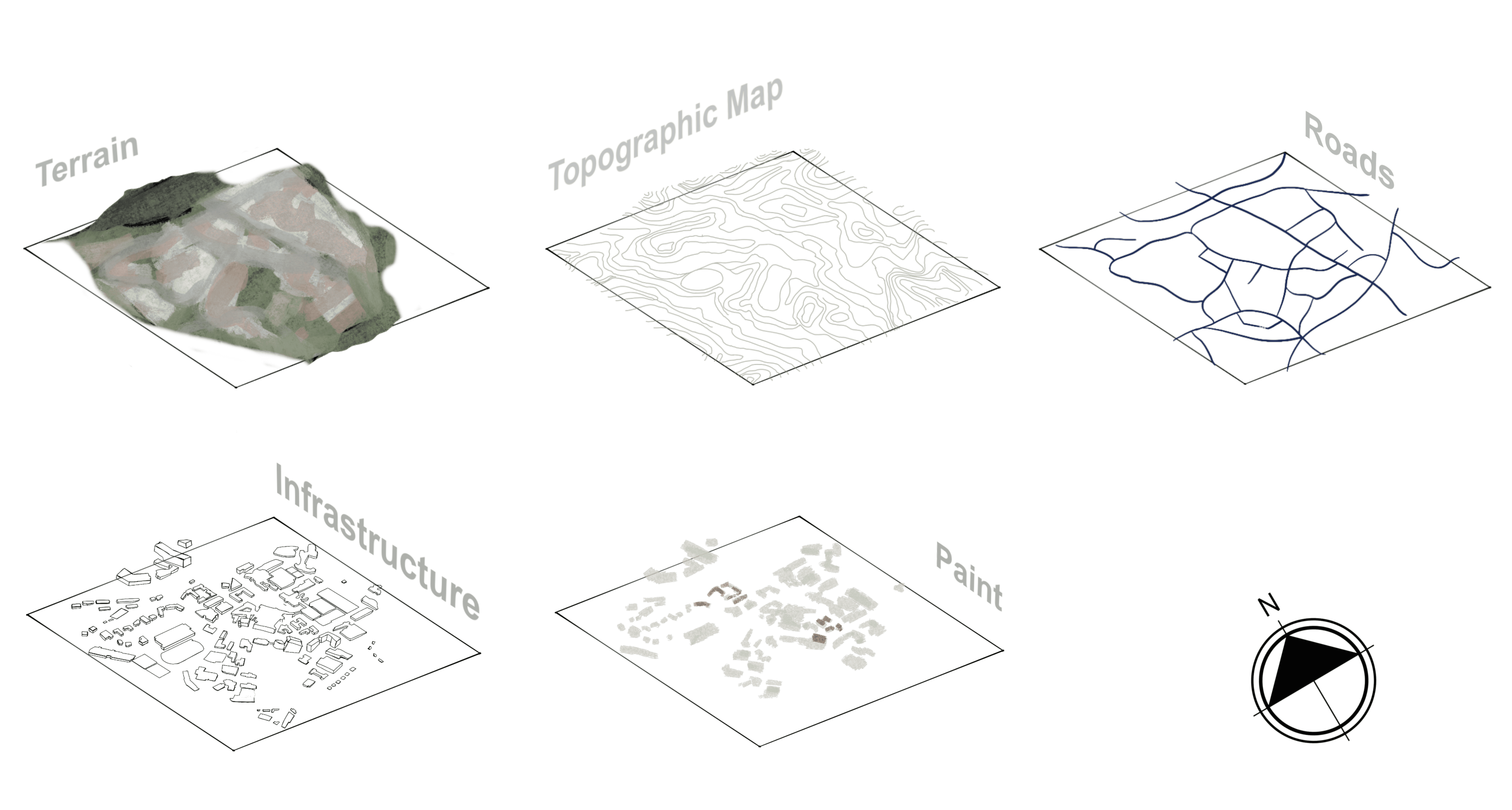
By combining multiple general maps and personal experience with the campus, I created this diagram that explores the relationship between terrain, topography, and infrastructure. In my specific design of this relationship, I attempt to allow the viewer to separate one by one the different elements that combine to create the campus we know today.
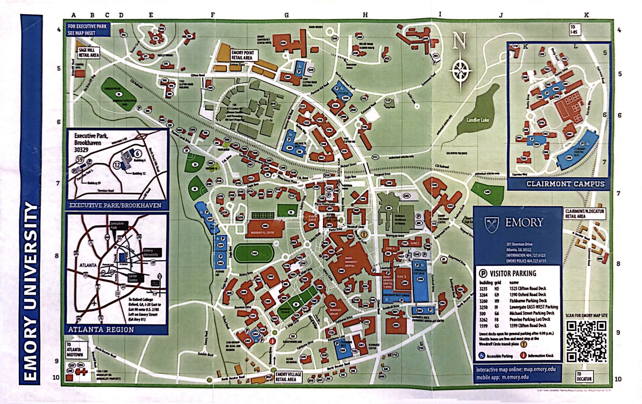
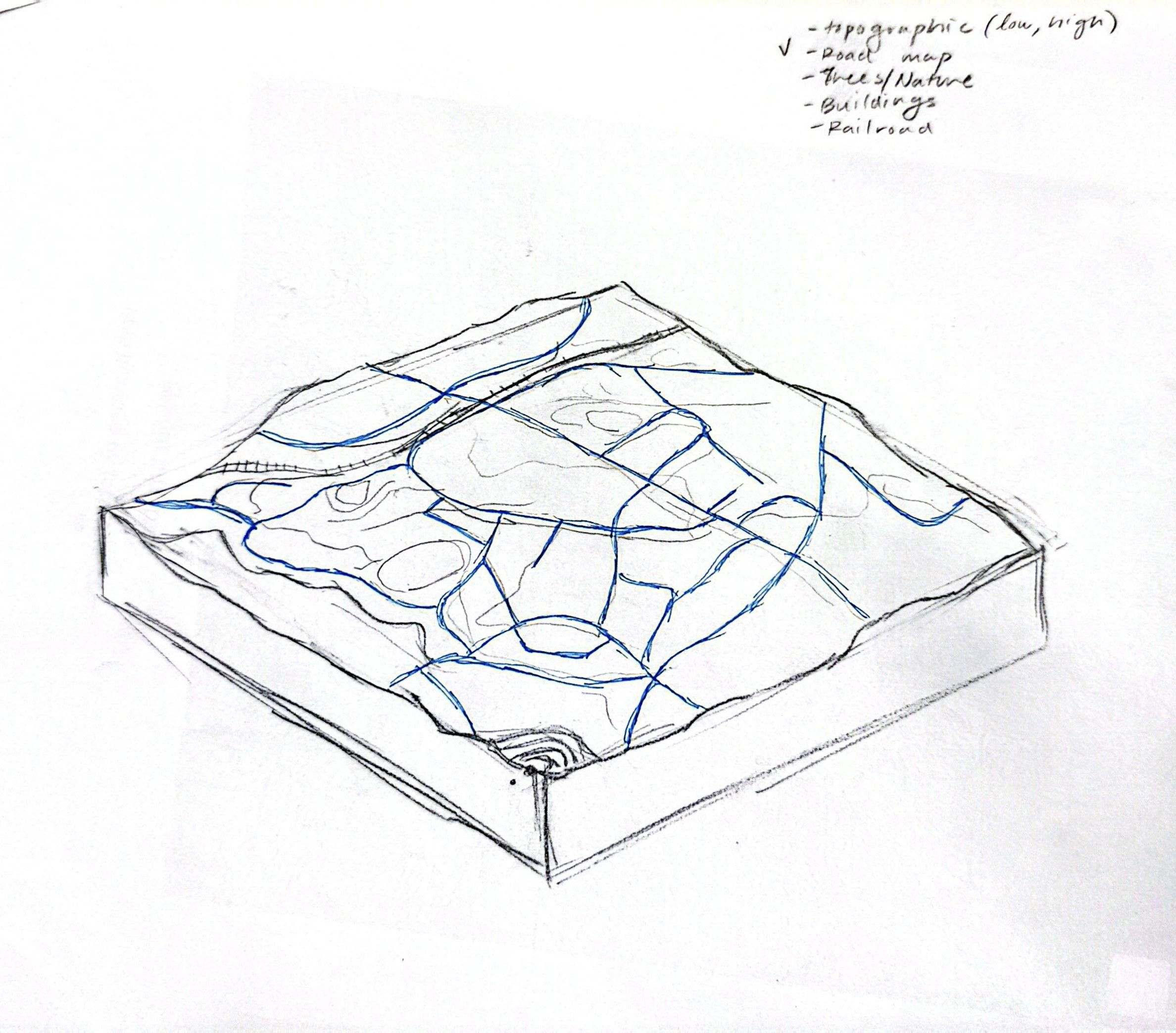
By studying how people moved and interacted on a population-wide basis, I was able to understand Emory's architecture and spatial design through a people-centric lens. As this project analyzes Emory's campus not just as architecture but as a system, the maps I created focused on how infrastructure and spatial design influenced formation of community. By mapping circulation and key access points, I evaluated how certain design choices could be holistically improved to impact efficiency, accessibility, and interaction, all while maintaining other societal considerations. More than just a campus, Emory's layout became a strategic lever to shape human behavior at a large scale.
Utilizing these general maps, I translocated each one onto a stackable layer map. I wanted to centralize these different forms of cartography onto a single diagram, increasing accessibility and encouraging visual dialogue.
From my own experience of understanding each of the university's multi-layered systems that all contribute to Emory's overall brand and functionality, I wanted to reflect this process of identity shaping, especially in an creative, artistic form.
Utilizing these general maps, I translocated each one onto a stackable layer map. I wanted to centralize these different forms of cartography onto a single diagram, increasing accessibility and encouraging visual dialogue.
From my own experience of understanding each of the university's multi-layered systems that all contribute to Emory's overall brand and functionality, I wanted to reflect this process of shaping identity, especially in an creative, artistic form.
It was an interdisciplinary experience that undoubtedly shown a light in how a multitude of elements come into play, from architecture to terrain and topography, and prompts even further questions of how we might approach the histories and considerations of all these elements in our lived experiences or other projects which inevitably lead to their inclusion.
Utilizing these general maps, I translocated each one onto a stackable layer map. I wanted to centralize these different forms of cartography onto a single diagram, increasing accessibility and encouraging visual dialogue.
From my own experience of understanding each of the university's multi-layered systems that all contribute to Emory's overall brand and functionality, I wanted to reflect this process of identity shaping, especially in an creative, artistic form.